Testing XSL
file://e:\websites\public\12571880\12571880_OttawaPoliceService\en\rotatingimages\rotatingImageData.xml
defaultInterior
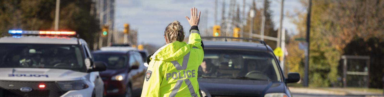
Transparency in Action: OPS Data Team Earns Global Spotlight
.jpg)
When Anastasia Kurbakovskaya joined the Ottawa Police Service (OPS) as a Senior Geospatial Data Analyst, she never imagined that one of her maps would one day be featured on the biggest stage in geographic information systems (GIS).
“The OPS Traffic Stop Race-Based Data Collection Dashboard was featured in the Environmental Systems Research Institute (Esri) User Conference Keynote Plenary in San Diego. This is the largest GIS event, with over 20,000 attendees,” said Cameron Hopgood, Director of Strategy.
“This recognition goes beyond innovation. It reflects our focus on transparency, equity, and evidence-based policing. It shows how OPS is working with partners to support community safety through geospatial technology. We’re encouraged to see this work recognized on a global stage.”
Anastasia, who specializes in transforming raw data into accessible, public-facing dashboards and maps, is quick to point out that this recognition is as much about community impact than it is about technical achievement.
“Our goal is to empower residents,” she explained. “We want people to access the same information police members have—so when a community policing officer is asked, ‘Are car thefts increasing in my neighbourhood?’ They can pull up a public dashboard and walk someone through the data in real time. Better yet, that person can also explore the data themselves.”
At the core of her work is transparency—presenting data that matters to the public, in a format they can understand and use. The dashboards built by Anastasia and her team don’t just display numbers; they tell stories. They’re carefully crafted to respect privacy by geomasking locations, rounding times to avoid over-disclosure, and translating internal database field names into plain language.
The map that earned international recognition at Esri’s San Diego conference was developed to complement OPS’s 10-year Traffic Stop Race-Based Data Collection Report. Unlike the report, which focused on statistical breakdowns, Anastasia’s map added new dimensions: time and space.
With almost half a million traffic stops across Ottawa, she faced the challenge of visualizing massive data without overwhelming users. “You can’t just plot dots on a map—it would just look like a cloud,” she laughed.
Instead, she used binning—dividing the city into a grid of cells and aggregating the data within each one. She then layered in color and transparency to distinguish not only volume, but outcome. Three colors represented different traffic stop outcomes—charged, final, and warning—chosen with care to avoid any unintended emotional interpretations.
When the Esri plenary began streaming live, Anastasia never expected to see her work on display. “I had submitted the map months earlier for consideration,” she recalled. “I was watching the live stream when I suddenly thought, ‘that looks really familiar.’ Then I noticed it in the bottom right corner—and realized, that’s our map!”
What made the moment even more special is that she hadn’t even been notified—Esri doesn’t tell you if your submission is chosen for the plenary. “You just have to watch,” she said. “So I did. And there it was, and it clearly said Ottawa Police Service.”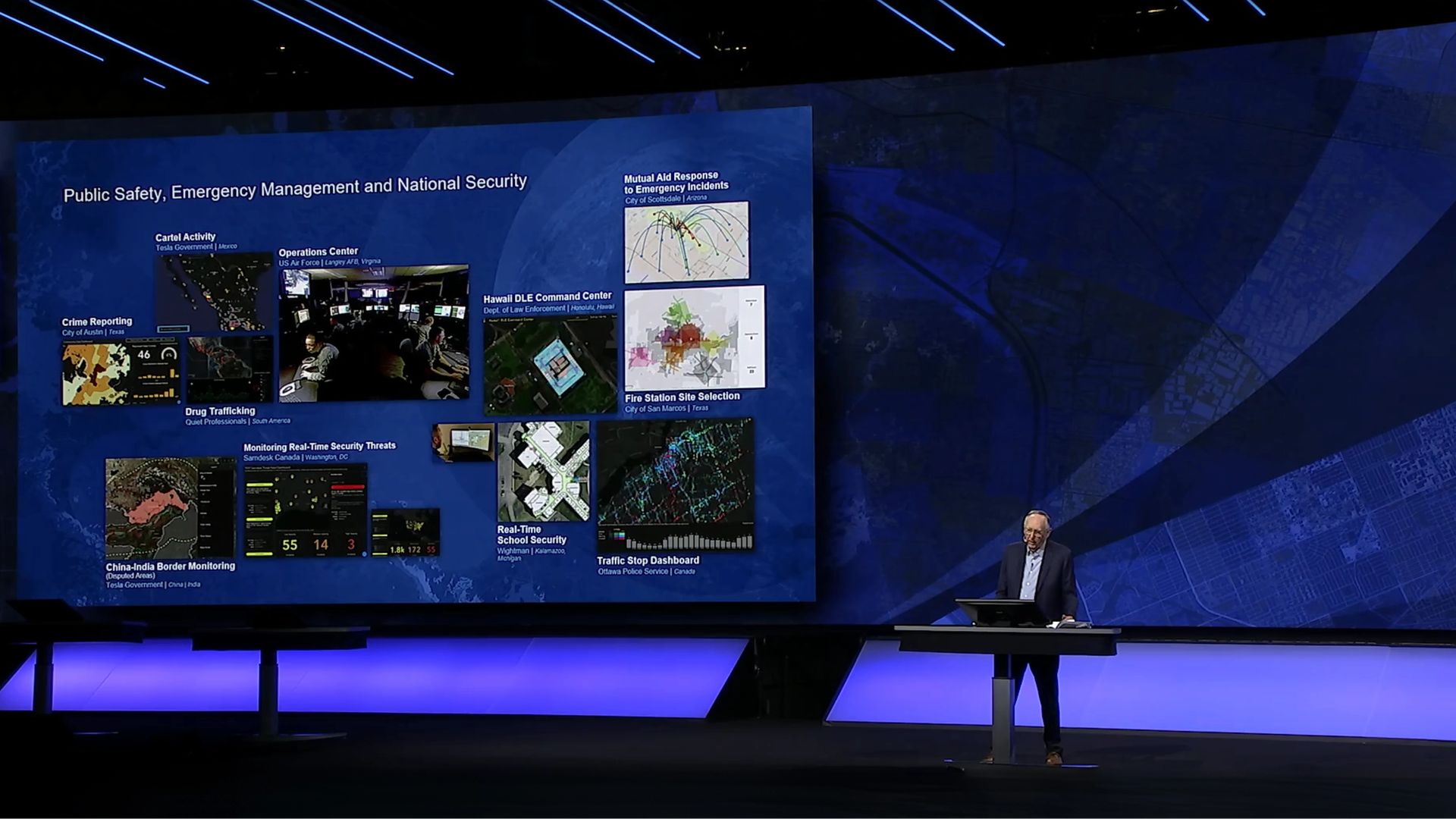
Beyond the international recognition, Anastasia says the most rewarding part of her work is helping the public have meaningful conversations rooted in facts. “There’s so much misinformation out there. People say ‘this area has a lot of crime,’ or tell their friends moving to Ottawa, ‘that’s a bad neighbourhood,” but what does that mean? Our tools let you look that up yourself—whether it’s property crime, violent crime, or something else entirely. That information empowers people to make decisions based on reality.”
She’s also proud of how far the Community Safety Data Portal (CDSP) has come. Since its launch in 2023, the platform has evolved through ongoing public feedback. “We’ve redesigned our surveys to ask better questions. Instead of just ‘Did you find what you were looking for?’ we now ask if you’d like to see new datasets like calls for service or more frequent updates to bike theft data,” she explained.
“There are many other projects the team is working on in an effort to create a better product for the residents,” she added. “The work we’ve done around web accessibility–sufficient colour contrast, ensuring keyboard navigation, providing captions for videos, implementing alt text for images–are great examples.”
The team is now observing how users interact with the portal. which allows them to identify areas that are confusing or unclear.
“The CSDP is a home to many great maps, dashboards, and datasets that each tell a story and are each helpful for the community in its own way, “she said. “There is a lot of talent, unique skills, and fresh ideas on this team – we are just getting started.”
In doing so, she’s helped reshape how OPS engages with the community, proving that even the most complex data can be a tool for trust, dialogue, and progress.
OPS Community Safety Data Portal will be featured at the 2025 Esri Canada User Conference, which will take place on November 2 to 4, in Toronto. The CSDP team's proposal was officially accepted, offering a chance to showcase the Portal alongside leading GIS innovations from across the country.